


Create individual maps for your places, tracks and events. Share your maps in real-time. Try it now on mapforge.org.
Mapforge is an open source, easy to use GIS software. It's a web application that lets you create and share your places, tracks and events as GeoJSON layers on top of different base maps. It uses MapLibre GL JS as map library and supports both desktop and mobile.
Your browser connects to the server via WebSockets, so that changes are immediately synced to all clients. This enables collaborative editing and sharing real-time maps.
The main instance is running at mapforge.org, see self-hosting how to run your own. Check the changelog for recent changes. Contributions are welcome, see CONTRIBUTING.md.
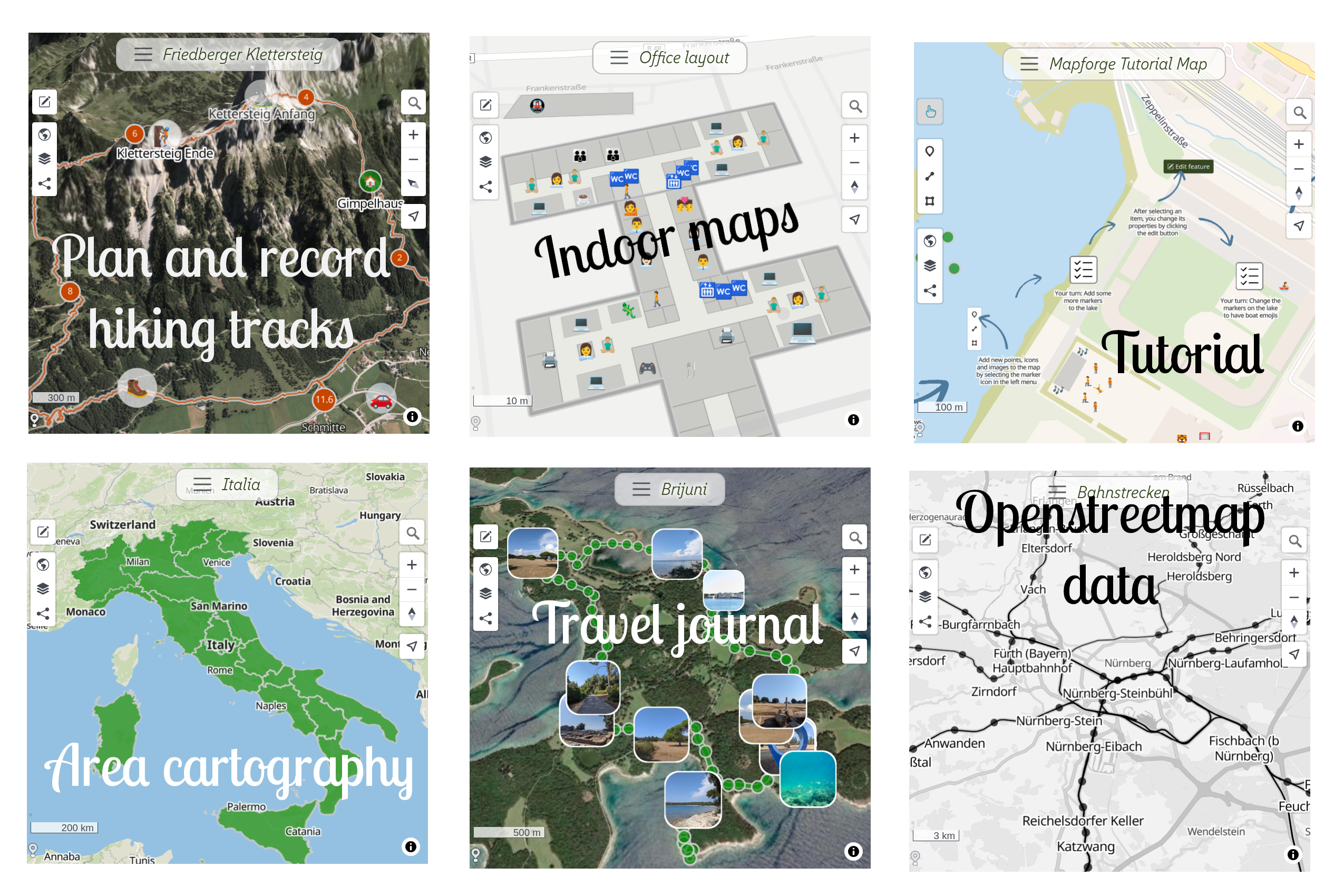
- Create maps with your own data on top of various available base maps.
- Self-host via container image, needs only Redis and MongoDB
- Draw shapes and style them: Add pictures, customize colors, symbols, labels, (3D) polygons and more
- Import and export GeoJSON, GPX and KML
- Real-time collaborative editing, changes sync to every connected client over WebSockets
- Share maps and embed on your own web page
- Desktop and mobile UI
- Integration with Overpass API for custom OpenStreetMap queries
- Login with Google, GitHub or OSM OAuth, no auth system to maintain
- PWA support by default, ships as an Android app via Bubblewrap
- Record GPS tracks with the built in µlogger API
GeoJSON layers can be styled using an extended version of the GeoJSON / Mapbox simplestyle spec. See docs/tutorials/geojson_style_spec.md for supported attributes.
Overpass API layers can be added to a map, allowing custom queries and display of OpenStreetMap data. See docs/tutorials/overpass_layers.md for details.
Mapforge is built as a Progressive Web App (PWA), see docs/tutorials/app.md.
An Android app that wraps the PWA is available in the Play Store: Mapforge Android App
The latest image is available from ghcr.io/mapforge-org/mapforge:main.
You can also build your own image locally from the repository with: podman build -t mapforge .
Before running the application container, make sure MongoDB and Redis are running. For example with Podman:
podman run -d --name mongo \
  -v <local_dir>:/data/db:U,z \
  -p 27017:27017 \
  mongo:8.2

podman run -d --name redis \
  -p 6379:6379 \
redisA minimal example using the GitHub Container Registry image:
podman run \
  --name mapforge
  -e SECRET_KEY_BASE=e3c9f2... \
  -e DEVELOPER_LOGIN_ENABLED=true \
  --network=host \
  ghcr.io/mapforge-org/mapforge:main
To persist data like uploaded images in your storage, mount these to the container by adding to the podman command:
-v /path/on/host/maps:/rails/public/previews
-v /path/on/host/rails_storage:/rails/storage
-v /path/on/host/rack_cache:/rails/tmp/cache/rack
To enable geolocation-based centering of maps, mount the MaxMind GeoLite2 database:
podman run ... -v /path/on/host/GeoLite2-City.mmdb:/rails/db/GeoLite2-City.mmdb ...SECRET_KEY_BASE— Rails secret key (must be set in production)DEVELOPER_LOGIN_ENABLED— optional local developer login (only enable this in test instances)HTTP_PORT— HTTP port inside the container (default: 3001 for thruster, 3000 for puma)SSL— set totrueif your container is running behind a TLS terminating reverse proxy (default: true)MONGO_URL— MongoDB connection string (default:localhost:27017)MONGO_DB— MongoDB database name (default: 'mapforge_production')MONGO_USER,MONGO_PASSWORD— MongoDB credentials (optional; leave unset to connect without authentication)REDIS_URL— Redis URL for Action Cable (default:redis://localhost:6379/1)OPENROUTESERVICE_KEY— API key for routing features with openrouteservice.orgINDOOREQUAL_KEY— API key for IndoorequalTHUNDERFOREST_KEY— API key for Thunderforest mapsPROTOMAPS_KEY— API key for Protomaps mapsGITHUB_CLIENT_ID,GITHUB_CLIENT_SECRET— GitHub OAuth credentialsGOOGLE_CLIENT_ID,GOOGLE_CLIENT_SECRET— Google OAuth credentialsOSM_CLIENT_ID,OSM_CLIENT_SECRET— OSM OAuth credentialsDEFAULT_MAP— default base map identifier (default: versatilesColorful)